A single photo posted online may reveal more than its subject. With new artificial intelligence systems designed to analyze visual clues embedded in images, a screenshot or social media photo can now be used to identify a precise location—sometimes within just a few meters. The technology, powered by advanced computer vision models trained on millions of geotagged images, is capable of recognizing landmarks, vegetation patterns, architecture, terrain, and even shadows to determine where a picture was taken. – geospy.
I have watched the rapid expansion of AI-powered investigative tools over the past few years, but few developments feel as simultaneously impressive and unsettling as automated photo geolocation. Systems like GeoSpy and similar visual analysis platforms can often identify cities, streets, and even specific buildings from seemingly ordinary photographs. Even when GPS metadata has been removed from a file, the visual environment itself can act as a fingerprint.
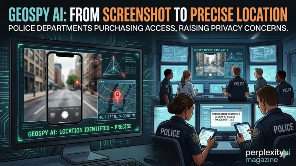
Law enforcement agencies have begun experimenting with the technology. Public records show that the Miami-Dade Sheriff’s Office purchased licenses for GeoSpy tools at a cost of roughly $85,500, while the Los Angeles Police Department’s Robbery-Homicide Division has also obtained access for investigative work. According to internal communications reported by investigative journalists, the systems are used primarily as “lead-generation tools,” helping detectives narrow down potential locations before verifying findings through traditional methods.
But the implications extend far beyond policing. Privacy advocates warn that the same technology available to investigators could also be used by stalkers, criminals, or curious strangers analyzing public photos. As artificial intelligence continues to expand its ability to interpret the visual world, a simple image may now contain far more information than the person sharing it ever intended.
The Rise of AI-Powered Photo Geolocation
For years, investigators and open-source intelligence researchers have used clues in photographs to determine where images were taken. This process, known as geolocation, traditionally required extensive manual research—examining signage, landscapes, building styles, and satellite maps.
Artificial intelligence is now automating that process.
Modern computer vision models are trained on massive image datasets containing millions of photographs linked to geographic coordinates. By learning patterns associated with different environments—architecture styles, road markings, vegetation types, soil color, and lighting conditions—these models can infer location with remarkable accuracy.
Tools like GeoSpy and platforms such as “Where Was This Photo?” apply these techniques to uploaded images. Users submit a picture or screenshot, and the system analyzes visual features to estimate geographic coordinates.
The result often appears within seconds.
Accuracy varies depending on image quality and available landmarks. Outdoor photos containing identifiable features tend to yield the most precise results. In many cases, the AI can narrow the location to a specific neighborhood or street block.
Researchers have previously demonstrated similar capabilities. In a widely cited 2015 study, computer scientists showed that deep neural networks trained on large image datasets could predict photo locations worldwide with surprising accuracy (Weyand, Kostrikov, & Philbin, 2016).
Today’s systems build on those foundations with far larger training datasets and more powerful models.
Read: Google’s PaperBanana Automates Academic Diagrams
How the Technology Works
AI geolocation tools rely on computer vision algorithms capable of interpreting complex visual signals within an image. Instead of looking for metadata or embedded GPS coordinates, the system analyzes the environment itself.
The process typically includes several steps:
- Feature detection – identifying objects, structures, and natural elements in the image.
- Pattern comparison – matching visual features to massive image databases.
- Geographic inference – predicting likely coordinates based on similarity patterns.
- Confidence scoring – assigning probability values to potential locations.
Even subtle details can provide clues.
Streetlights, road textures, license plate formats, vegetation types, and building materials often differ by region. Shadows can indicate latitude. Mountains or coastlines may further refine the location.
Dr. Serge Belongie, a computer vision researcher at Cornell University, has explained that modern AI models can recognize geographic patterns invisible to humans. “Neural networks trained on millions of images learn subtle visual signals tied to location,” he noted in research on visual geolocation systems (Weyand et al., 2016).
This capability means that even relatively ordinary images can reveal their origins. – geospy.
Tools That Can Identify Locations from Photos
Several AI platforms now offer automated geolocation capabilities. While GeoSpy has gained attention for law enforcement adoption, it is not the only system available.
AI Photo Geolocation Tools
| Tool | Type | Capabilities | Access |
|---|---|---|---|
| GeoSpy | Commercial AI geolocation platform | Identifies locations from photos with high precision | Licensed access |
| Where Was This Photo? | Public AI tool | Analyzes images and screenshots for geographic clues | Free |
| FindPicLocation | Web-based geolocation tool | Uses computer vision to estimate photo origin | Public |
GeoSpy is designed specifically for investigative workflows. The system reportedly allows both global geolocation searches and custom regional models trained for specific cities or regions.
In contrast, publicly available tools focus more on casual or research use.
Despite these differences, the underlying technology is similar: computer vision models trained to recognize geographic patterns.
The accessibility of these tools has raised concerns among privacy advocates who fear that geolocation capabilities once limited to experts are now available to anyone with internet access.
Law Enforcement Begins Buying Access
The growing interest in AI geolocation tools has not been limited to technology enthusiasts. Police departments have begun exploring how the technology might support investigations.
Public records obtained by investigative journalists show that the Miami-Dade Sheriff’s Office purchased access to GeoSpy, spending approximately $85,500 on licenses. The department reportedly tested the system through its cybercrimes unit, particularly in cases involving online exploitation imagery.
The Los Angeles Police Department’s Robbery-Homicide Division has also acquired access to the technology.
Confirmed Police Purchases
| Agency | Division | Purpose | Cost |
|---|---|---|---|
| Miami-Dade Sheriff’s Office | Cybercrimes Unit | Online exploitation investigations | $85,500 |
| Los Angeles Police Department | Robbery-Homicide Division | Criminal investigation support | Not publicly disclosed |
According to internal communications reported by investigative outlet 404 Media, law enforcement agencies treat the AI results strictly as investigative leads rather than definitive evidence.
Detectives must verify the location using traditional investigative methods before pursuing further action.
Still, the technology can significantly narrow search areas in cases where investigators have only an image to work with.
Investigative Advantages in Criminal Cases
In certain criminal investigations, even a small clue can prove decisive. Photos shared online—whether by suspects, victims, or witnesses—sometimes contain environmental details that can lead investigators to a location.
AI geolocation tools can analyze those clues in seconds.
For example, a photo containing distinctive architecture, landscaping, or road markings might allow the system to identify the likely city or neighborhood. Investigators could then cross-reference that location with other evidence.
This capability has particular relevance in cases involving online crimes, where suspects may share images without revealing their location.
According to cybersecurity researcher Hany Farid, digital image analysis has become an increasingly important investigative technique. “Images contain a tremendous amount of information beyond what the human eye sees,” Farid has explained in research on forensic image analysis (Farid, 2016).
AI simply accelerates the discovery of those clues.
For law enforcement agencies facing large volumes of digital evidence, automated geolocation could become a powerful investigative shortcut.
Accuracy and Limitations
Despite impressive demonstrations, AI geolocation systems are not infallible.
Accuracy depends heavily on the characteristics of the image being analyzed. Photos containing distinctive visual features tend to produce better results than generic scenes.
Factors Affecting Geolocation Accuracy
| Factor | Effect on Accuracy |
|---|---|
| Distinctive landmarks | High accuracy |
| Clear architecture | Strong location signals |
| Vegetation patterns | Moderate clues |
| Generic landscapes | Low accuracy |
| Indoor photos | Very limited accuracy |
| Blurry or low-resolution images | Reduced precision |
Outdoor environments provide the most useful data points.
Coastal regions, mountain ranges, city skylines, and recognizable infrastructure often allow AI models to pinpoint locations with impressive precision. However, visually similar environments—such as suburban neighborhoods or rural landscapes—can confuse the system.
In those cases, the AI may identify only a general region rather than an exact location.
For this reason, investigators treat AI-generated results as probabilistic estimates rather than confirmed coordinates.
Privacy Risks in the Age of Visual Intelligence
While law enforcement agencies emphasize investigative benefits, privacy experts worry about broader societal implications.
The most significant concern is accessibility.
Unlike traditional geolocation methods requiring expertise in open-source intelligence techniques, AI tools can automate the process for anyone. A person could upload a publicly shared photo and receive a location estimate within seconds.
That capability introduces new risks.
Social media users frequently share images from homes, workplaces, or vacation locations. Even if GPS metadata is removed, visual details such as neighborhood architecture, road signs, and landscaping may reveal the location.
Digital privacy researcher Kate Crawford has warned that machine learning systems can extract unintended information from everyday data. “AI systems increasingly reveal patterns that people never intended to share,” she wrote in her book Atlas of AI (Crawford, 2021).
For individuals targeted by harassment or stalking, the technology could make location tracking significantly easier.
The Expansion of Algorithmic Surveillance
Another concern involves the potential expansion of surveillance capabilities.
If AI systems can identify locations from images at scale, organizations could analyze massive collections of photographs to track movements, identify patterns, or map social networks.
This possibility has raised alarm among civil liberties groups.
Albert Fox Cahn, executive director of the Surveillance Technology Oversight Project, has argued that emerging technologies require stronger oversight mechanisms. “Powerful surveillance tools demand meaningful accountability before they become widespread,” he has warned in discussions about law enforcement technology adoption.
Even when used for legitimate investigations, the broader implications remain unsettled.
History has repeatedly shown that technologies initially developed for limited use can eventually spread into broader surveillance systems.
Protecting Yourself from AI Geolocation
For individuals concerned about privacy, several steps can reduce the risk of AI identifying a photo’s location.
The most important measures involve limiting both metadata and visual clues.
Disabling location tagging on smartphone cameras prevents GPS coordinates from being embedded in photos. Removing metadata before sharing images provides an additional layer of protection.
Visual details also matter.
Cropping out recognizable landmarks, street signs, or distinctive buildings can reduce the amount of information available to AI systems. Blurring backgrounds or sharing photos after leaving a location further reduces the risk of real-time tracking.
Cybersecurity experts often emphasize that digital privacy depends on understanding how data can be interpreted.
In an era where machines can analyze images at extraordinary scale, even small visual details can carry surprising significance.
Takeaways
- AI geolocation systems can identify photo locations by analyzing visual clues rather than relying on GPS metadata.
- Tools like GeoSpy can sometimes pinpoint locations within a few meters when distinctive environmental features are visible.
- The Miami-Dade Sheriff’s Office and Los Angeles Police Department have purchased licenses for investigative use.
- Law enforcement treats AI-generated coordinates as investigative leads rather than definitive evidence.
- Privacy experts warn that the technology could enable stalking, harassment, or mass surveillance.
- Individuals can reduce risk by removing metadata, cropping identifiable backgrounds, and limiting public photo sharing.
Conclusion
Artificial intelligence has always promised to reveal hidden patterns in data. Increasingly, that data includes the visual world around us.
AI-powered photo geolocation represents a remarkable technical achievement. By learning geographic signals embedded in millions of images, modern computer vision systems can identify places with precision that would have seemed impossible a decade ago.
For investigators, the technology offers a new tool capable of narrowing search areas and accelerating digital investigations. In cases where photographs provide the only available clues, automated geolocation may prove invaluable.
Yet the same capability also raises profound questions about privacy in a world saturated with images.
Every day, billions of photos are shared across social media platforms. Each one captures fragments of the physical world—buildings, landscapes, streets, and skylines. If artificial intelligence can interpret those fragments with increasing accuracy, the boundary between public imagery and private location may become increasingly fragile.
The technology itself is neutral. Its impact will depend on how society chooses to regulate, deploy, and understand it.
What is certain is that the humble photograph—once a simple snapshot—now contains more information than most people realize.
FAQs
Can AI really find a location from a single photo?
Yes. Modern AI geolocation systems analyze visual clues such as architecture, terrain, vegetation, and infrastructure. With distinctive features present, they can sometimes identify locations within a few meters.
Does removing GPS metadata stop AI geolocation?
No. Removing metadata prevents GPS coordinates from being read, but AI systems can still analyze visual details within the image itself to estimate the location.
Which police departments use GeoSpy?
Public records indicate that the Miami-Dade Sheriff’s Office and the Los Angeles Police Department have purchased licenses for investigative use.
How accurate are AI geolocation tools?
Accuracy varies depending on image quality and visual clues. Distinctive landmarks can enable meter-level precision, while generic environments may only reveal a general region.
How can I protect my photos from being geolocated?
Disable location tagging in camera settings, remove EXIF metadata before sharing, crop recognizable backgrounds, and avoid posting photos in real time from sensitive locations.